PAS 128 compliant utility survey is a cost-effective risk management tool for mitigating both Health & Safety and financial risks. • Demonstrate compliance with all Health and Safety regulations and ensure best practice for your company and employees • Avoid heavily congested areas for new utility routes & excavations • Unnecessary excavation kept to a minimum • Highly accurate data provided • Locate utilities on what appears to be disused ground • Detect and map underground utilities before you start on site, minimising risk of injury to workers and neighbours • Improve project planning, reduce project downtime and avoid costly rescheduling • Detect underground fuel tanks, data cables and fibre optics • Identify safe areas for boreholes, locations, window samples and trial pits •
Embark on your construction project with confidence PAS 128 offers 4 levels of survey with the option of post processing. Simply these are defined as below:-
Quality Level D:
Request all utility record information from all of the relevant asset owners. With this survey level, we provide the client with all of the stat plans from the asset owners. This will show the client where the main lines of the asset are based. This survey is often know as a Desktop Survey.
Quality Level C:
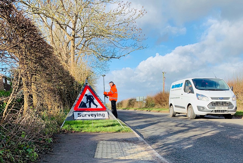
Request a Site Reconnaissance Survey. We go to the area and locate the physical features that support the existence of utilities in the survey area. This includes the type and markings of utility related surface features, measurements between known surface features on the ground compared with those depicted on the plan (if available), differences between the map/drawing or digital features supplied and those extant on the ground. Surface features to be included in the on-site checks shall include as a minimum: Manhole and inspection chamber covers, valve covers, utility markers, control and distribution pillars and columns, LV power, street lighting, traffic lights, and historic excavation scar lines.
Quality Level B:
This involves electromagnet and ground penetrating radar surveys of the whole site area. This includes depths and positions on all utilities including, but not limited to: • Electricity • Gas • Water • British Telecommunications • Drainage • Fibre Optics • Radio Signals • Camera Cables (CCTV) Post processing can also be requested on the Radar data. This gives more accuracy and allows a clearer picture into the ground for the client.
Quality Level A:
This level of survey incorporates Level B, but also backs up the data with a series of excavations to expose the target utilities within the survey area. Once the client has received the finished drawing for Quality Level B, they can choose the areas that they would like to have the utilities exposed in and then the data confirmed on site can they be added to the drawing with the quality and accuracy updated if necessary.
Recommendations:
These reports can all be issued in isolation, but we recommend that you undertake works to include Level D and Level B. This gives you the best initial level of information quickly. Level A is reserved for sites that have very congested services or where specific requirements are placed on the contractor by the asset owners. More information is available upon request, just call the number below and we would be happy to talk through your requirements.